
Satellite Humidity & Irrigation Service
Click here to download the PDF
Satellite Humidity & Irrigation Service
Welcome. In this video, we explore one of the most practical examples of how Earth observation technologies can support precision agriculture. While many satellite services focus on monitoring and analysis, the humidity and irrigation service integrated into EagleArca takes a step further. Its objective is not simply to describe the current condition of agricultural land, but to support daily operational decisions, answering one very practical question: where, when, and how much should we irrigate. This shift, from describing a field to actively advising on it, is what makes the service distinctive. Throughout this video, we will look at why such a service is needed, the philosophy behind it, the information it draws upon, how it reaches a decision, and finally how all of this is delivered and visualized within the EagleArca platform.
Why This Service Exists
Agriculture has always depended on water availability. Traditionally, irrigation decisions have been based on experience, field observations and fixed schedules. However, modern environmental conditions are becoming increasingly complex. Water resources are limited, climatic conditions are more variable, and sustainable farming requires optimizing every available resource. For these reasons, the EagleArca humidity service was designed to transform heterogeneous environmental observations into daily irrigation recommendations. The goal is to replace rigid, generic schedules with guidance that adapts continuously to the real conditions of the land.
The Underlying Philosophy
The philosophy behind this service rests on an important principle: satellite images should not be interpreted as real-time snapshots of the field. Instead, they are treated as observations acquired at a certain point in time, which are then combined with continuously updated meteorological information, irrigation records and short-term weather forecasts. This is what allows the system to produce operational recommendations every day, even when new satellite imagery is temporarily unavailable. Rather than depending on the moment a satellite passes overhead, the service maintains a continuously evolving understanding of the field, updated daily from many sources.
The Three Questions
In practice, the service revolves around three fundamental questions. First, which portions of the cropland require irrigation today? Second, how much water is suggested? And third, can irrigation be postponed because rainfall is expected in the coming days? A key point is that the service does not generate a single recommendation for an entire field. Instead, it produces pixel-based decision maps, allowing different sections of the same field to receive different recommendations according to their local conditions. This spatial detail is what turns a general irrigation strategy into precise, site-specific guidance.
The Data Sources
To answer these questions, the service integrates multiple sources of information, each contributing a different piece of evidence. The first and most important source is weather information. Daily meteorological products provide temperature, precipitation, evapotranspiration, wind speed, humidity, runoff, cloud cover and estimates of soil water content. These variables represent the main driver of crop water demand and form the backbone of the decision-making process.
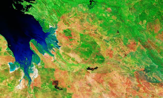
Sentinel-2 provides optical observations of vegetation. Through indices such as NDVI, NDMI, NDRE, SAVI and other spectral indicators, the system evaluates crop vigour, moisture stress, vegetation activity and the presence of possible surface water. These indicators help identify where crops are healthy, where they are experiencing stress, and where excessive water may already be present.
Sentinel-3 contributes thermal and atmospheric information. Parameters such as land surface temperature, vapour pressure deficit, dew point, soil wetness and cloud fraction provide additional evidence regarding atmospheric stress and field dryness. By combining optical and thermal observations, the service gains a much more complete understanding of crop conditions.
Sentinel-1 can optionally provide background information on soil moisture through radar observations. Since radar penetrates clouds and operates independently of daylight, it adds valuable information regarding field conditions. Terrain information derived from digital elevation models can also be integrated to estimate slope and runoff effects, since steeper terrain tends to lose part of the rainfall through runoff, reducing the amount of water that effectively contributes to soil moisture.
Another important component is the irrigation log. The system records the amount of water already applied to the field and uses this information to continuously update the field water balance. In addition, the service maintains what can be thought of as a simplified virtual water reservoir for every agricultural pixel. This virtual reservoir represents the amount of useful water currently available to the crop. Every day, the reservoir is updated according to a simple water balance equation: the previous water state, plus effective rainfall and irrigation, minus the estimated crop water demand. In this way, each pixel carries its own continuously updated memory of how much water the crop actually has at its disposal.
The Role of Forecasts
One of the most interesting aspects of the system is its use of weather forecasts. Instead of considering only today's conditions, the service analyses expected precipitation and evapotranspiration over the next 24, 48 and 72 hours. If the forecast indicates that upcoming rainfall will provide sufficient water to satisfy crop demand, irrigation can be postponed. In this way, the service avoids unnecessary irrigation, reducing water consumption and increasing sustainability. Looking ahead, rather than only at the present, is what allows the system to prevent waste before it happens.
The Decision Process and Operational Robustness
The final decision process combines all the available evidence: previous soil conditions, Sentinel-2 vegetation stress indicators, Sentinel-3 atmospheric information, optional Sentinel-1 soil moisture, forecast rainfall, evapotranspiration and terrain characteristics. An important feature of this design is its robustness. Even if some optional layers are missing, the system continues to operate, assigning a lower confidence score instead of interrupting the process. This design philosophy ensures that the service remains operational under real-world conditions, where data is not always complete.
The Outputs
The output generated by the service is far richer than a simple yes-or-no irrigation recommendation. Several GeoTIFF layers are produced. These include estimated water demand, suggested irrigation amount in millimetres, maps indicating where irrigation can be postponed, confidence scores and final decision classes. The decision map classifies every agricultural pixel into one of four categories: no data, no irrigation required, postpone irrigation, or irrigation recommended. Additional evaluation layers provide a simplified interpretation of crop water conditions using a traffic-light approach.
Green areas indicate adequate moisture, yellow regions suggest moderate concern, red areas correspond to water deficit conditions, and a separate category identifies zones where rainfall is expected to satisfy future water needs. Behind these classes lies a water deficit index ranging from zero to one hundred, which quantifies the severity of crop water stress. The service also produces forecast products describing expected rainfall and evapotranspiration over different time horizons.
This allows users to understand not only the current situation, but also how water availability is expected to evolve over the coming days. The ratio between forecast rainfall and crop demand provides an estimate of how much of the crop water requirement will be naturally satisfied by precipitation. Besides raster products, EagleArca generates human-readable summaries and smart alerts. These alerts transform complex geospatial statistics into operational messages. For example, the system may indicate that a large portion of the field requires irrigation, that irrigation can safely be postponed because rainfall is expected, or that the confidence of the decision is reduced because some information layers were unavailable.
Visualization in EagleArca
Inside EagleArca, all these products become georeferenced GIS layers that can be visualized in both 2D and 3D environments. Users can inspect irrigation recommendations spatially, compare them with vegetation health, soil moisture, temperature and weather layers, and observe how conditions evolve through time. Instead of treating agriculture as a collection of isolated measurements, EagleArca transforms satellite observations, weather models, irrigation logs and forecasts into a unified decision-support system.
Ultimately, this humidity and irrigation service represents an example of how Earth observation technologies are evolving from passive monitoring systems into active decision-support infrastructures. By combining satellite imagery, weather forecasts, historical information and field management data, the system helps farmers optimize water use, improve crop resilience and support sustainable agricultural practices. Rather than simply observing the field, the service continuously interprets its behaviour, predicts its future needs, and provides operational recommendations that can contribute to more efficient and climate-resilient agriculture.
No comments to display
No comments to display